.png)
WDNetGIS-XL
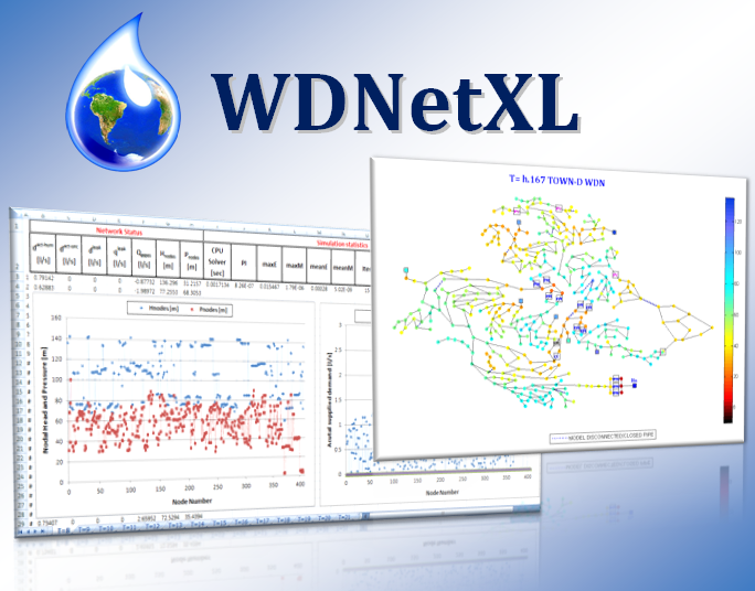
Advanced hydraulic modeling is an indispensable support and prerequisite for system management at various operational horizons. It overcomes the limitations of traditional models based on the modelling coding of EPANET and the last century. WDNetGIS-XL offers several innovative tools for advanced hydraulic and topological analyses in contrast with traditional approaches, as shown in the following table:
|
Hydraulic and topological functionality |
WDNetXL |
EPANET |
|
3D viewer |
YES |
NO |
|
Representation of hydraulic devices and valves as attributes of each link object |
YES |
NO |
|
Demand-Driven Analysis |
YES |
YES |
|
Pressure-Driven Analysis |
YES |
NO |
|
Analysis of variable level tanks within the GGA (G-GGA) |
YES |
NO (1) |
|
Analysis of variable level tanks supplied from nodes inside the network (from the bottom or from the top) or external pipelines, as well as volume-based controls for filling-emptying cycles |
YES |
NO |
|
Hydraulic analysis with real topological variations |
YES |
NO (2) |
|
Pressure-driven analysis to evaluate the water supply to individual users |
YES |
NO |
|
Pressure-driven analysis of hydrants |
YES |
YES (3) |
|
Pressure-driven analysis of volumetric losses (background leakages and unreported bursts) at individual pipe level |
YES |
NO (4) |
|
Pressure-driven analysis of local private tanks |
YES |
NO |
|
Pressure-driven analysis to evaluate the supply of multi-story buildings |
YES |
NO |
|
Pressure-driven analysis of free orifices connections |
YES |
NO |
|
Simple rules |
YES |
YES |
|
Complex rules |
YES |
YES |
|
Unlimited demand time pattern |
YES |
YES |
|
Patterns of pressure setting for valves and variable speed drive pumps |
YES (5) |
YES |
|
Pattern of speed factors for variable speed drive pumps |
YES |
YES |
|
Flow setting pattern for flow control valves |
YES |
YES |
|
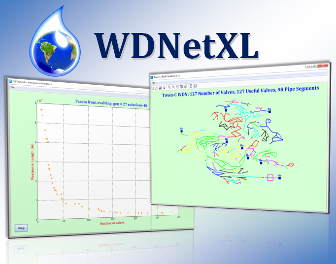
Topological analysis of districts (DMA) |
YES |
NO |
|
Topological analysis of the isolation valve system (IVS) |
YES |
NO |
|
Pressure-driven analysis of failures accounting for IVS |
YES |
NO |
|
Pressure-driven analysis of burst in the pipelines |
YES |
NO |
|
"Non-heuristic" modelling of pressure reduction (or sustain) valves locally and remotely (electrical) controlled (control with nodes inside the network) |
YES |
NO (6) |
|
"Non-heuristic" modelling of variable speed pumps with local control or with nodes inside the network |
YES |
NO (6) |
|
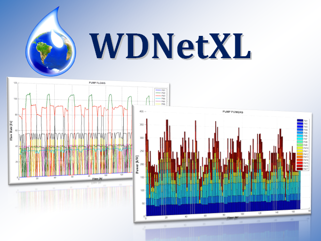
Energy consumption assessments and carbon footprint analysis of all types of pumps |
YES |
YES (7) |
|
Hydraulic analyses without aggregating demands of various users in the model nodes |
YES |
NO |
|
(1) EPANET, like all commercial software packages, does not calculate the level of the tanks within the GGA solver as a separate variable. The level of the tanks is corrected between one simulation and the following with a mass balance which, due to the lack of accuracy, causes errors that turn into instability when more variable level tanks are hydraulically close each other. The Generalized-GGA (G-GGA) solves the problem and allows hydraulic simulation even in the presence of only variable level tanks and absence of reservoirs. |
||
|
(2) EPANET, like all commercial software packages, does not perform topological analysis when a pipe is closed or closes during the simulation (hydraulic directional and/or pressure control devices), but assigns a minimum flow rate (10-6 L/s) to model the closure. This causes problems of accuracy and robustness of the solution, particularly for complex and/or large systems, not allowing different types of optimizations (for example the hydraulic optimization of DMA). WDNetXL, on the other hand, detects the topology before (e.g., in the case of an isolation valve system that separates a portion of the network during failure analysis) and during hydraulic simulations (e.g., for closing flow reversal devices unidirectional or controlled). |
||
|
(3) EPANET, like almost all commercial software packages, applies a modelling device to calculate emitters that are born as free orifices to simulate hydrants. The modelling artifice is not suitable for the calculation of a large number of hydrants, while WDNetXL calculates the hydrants as free orifices (with exponent also different from ½ for the case of bursts) within the G-GGA pressure driven, i.e. the method Newton-Raphson uses the derivative schemes in favor of accuracy (especially with reference to the global mass balances of the system), of the robustness and speed of the analysis. |
||
|
(4) EPANET, like all commercial software packages, does not calculate the volumetric losses as a function of the pressure at the level of the pipes, but uses the emitters in the nodes where what happens in the confluent pipes is concentrated. Besides the problems of accuracy and robustness of the simulation (see point 3), the method alters the realistic representation of volumetric losses and relative results. Furthermore, it does not allow the preservation of information at the pipe level, useful, for example, to plan its replacement. |
||
|
(5) WDNetXL allows, in addition, the possibility of setting the control pressure setting of variable speed pumps. |
||
|
(6) EPANET, like almost all commercial software packages, implements heuristic rules for calculating hydraulic resistance (valves regulated by pressure or flow). WDNetXL calculates the hydraulic resistances of controlled devices as variables within the G-GGA, thus allowing the control nodes of devices to be positioned also within the network. |
||
|
(7) EPANET, like almost all commercial software packages, does not use a variable efficiency value with the operating point of the variable speed pumps. WDNetXL calculates both the energy consumption and the power of the individual pumps, for each simulation of the operating cycle, considering the variable efficiency and also returning the value of the CO2 produced. |
||
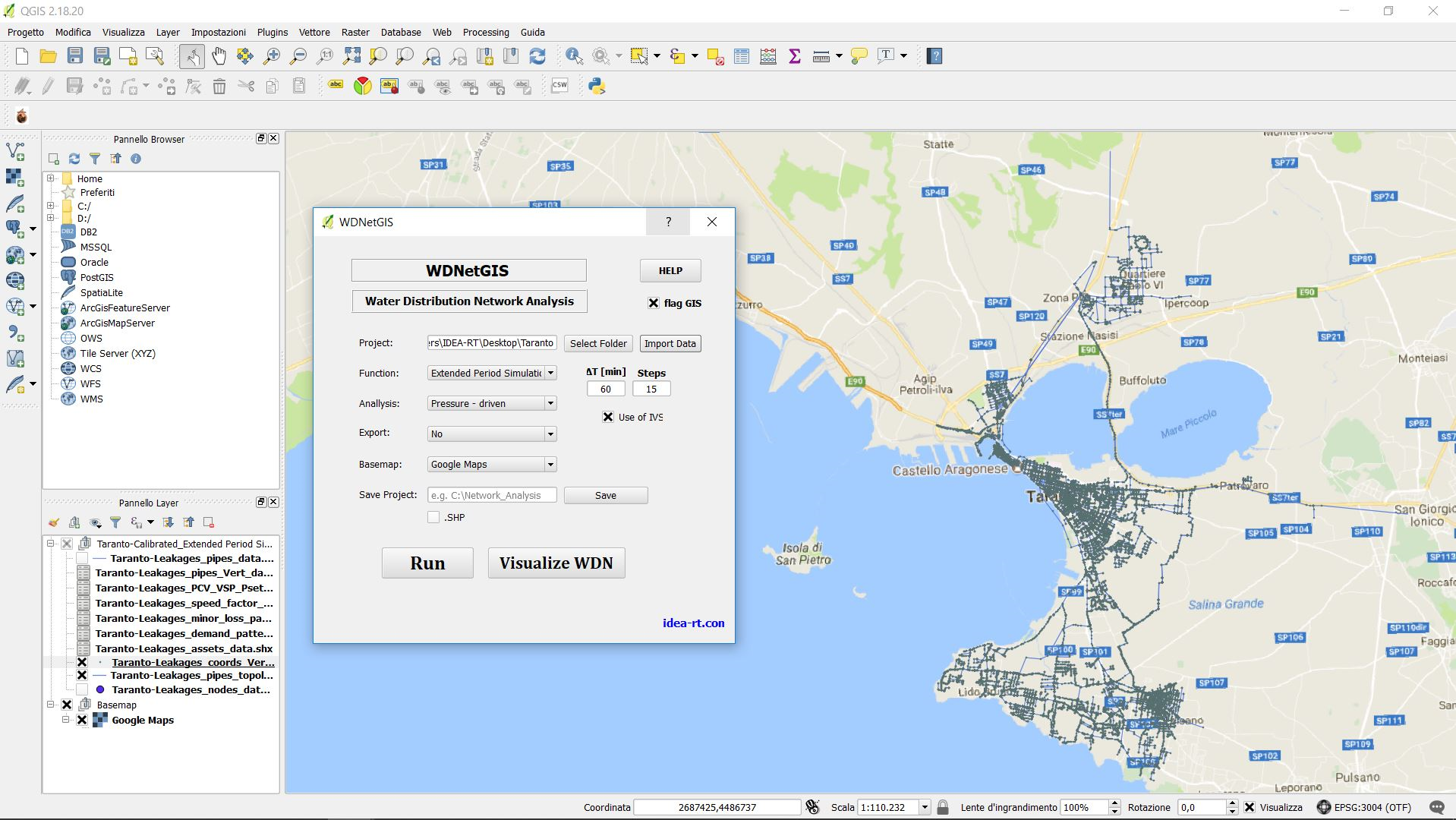
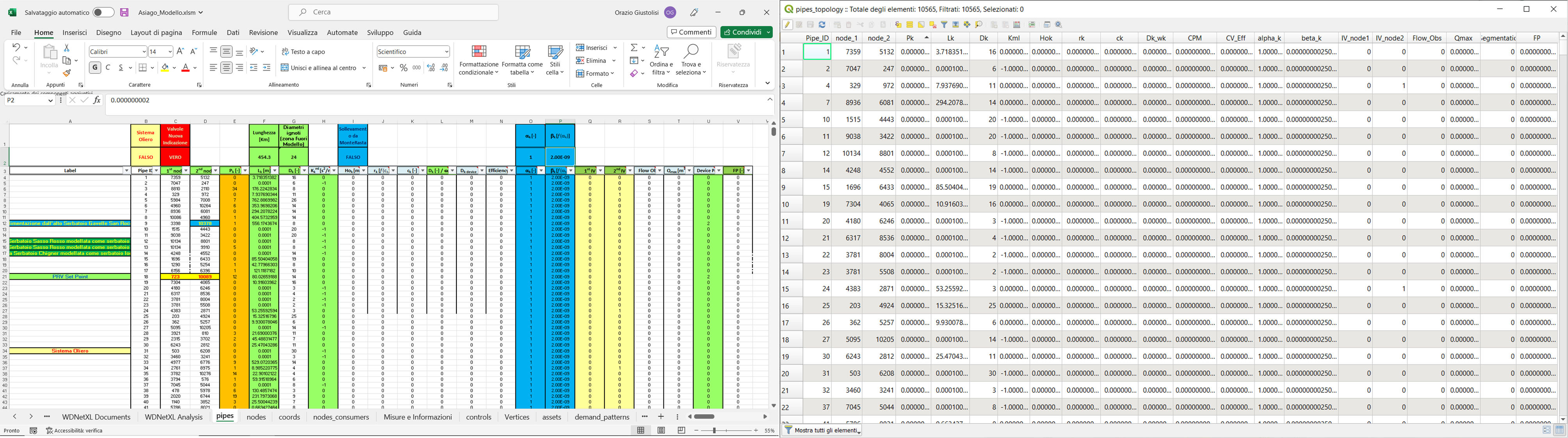
WDNetXL generates the Digital Twin of network. The Digital Twin has a data format that is completely interoperable with the hydraulic platform WDNetXL running in Microsoft Excel and the GIS environment. Hence, the data tables in WDNetXL are the same georeferenced in GIS with the ESRI system, as shown below. In this way, WDNetGIS-XL is connected to Microsoft Excel and GIS.
Digital Water Services
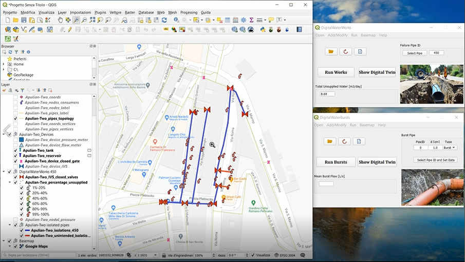
Digital Water ideas will change the future management of water distribution networks.
WDNetGIS-XL integrates the tools of Complex Network Theory (CNT), evolutionary multi-objective optimization and machine learning to perform advanced analysis through Digital Water Services (DWSs). Digital Water Services are developed as plugins for QGIS software, and they are completely customizable depending on the needs of water utilities. The basis for DWSs is the Digital Twin of the network. The digital model of the system is the twin of the real system because the topological and hydraulic features of advanced hydraulic modelling allow reproducing the actual behavior of water supply networks and the integration with the GIS allows georeferencing any hydraulic system component.
Digital Water Services support problem solving in several technical tasks using WDNetGIS-XL features: